Active Transportation Network Plan
Review the Draft Active Transportation Network Plan
The Fraser Valley Regional District has prepared a Draft Active Transportation Network Plan (ATNP) to help guide future improvements for walking, cycling, and rolling throughout the electoral areas. The plan identifies a proposed regional network, priority improvement areas, and strategies to enhance safety, accessibility, and connectivity.
We have created an interactive webpage that will guide you through the details of the ATNP. We invite you to review the draft plan and proposed active transportation improvement areas and share your feedback through our engagement email atnp@fvrd.ca or through the Let's Talk Active Transportation tab below. Your input will help ensure the final plan reflects community priorities and supports a connected, accessible, and sustainable transportation network for the future.
About the Project
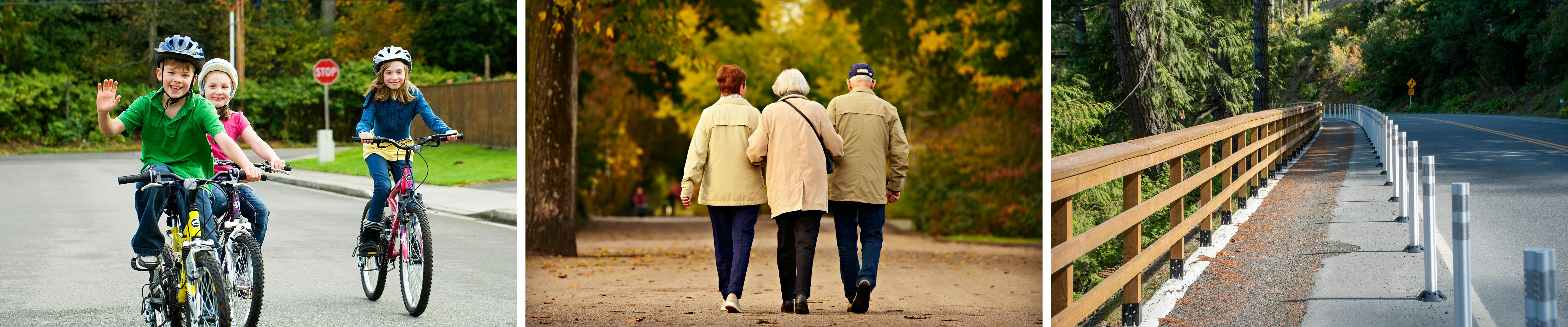
The FVRD has developed an Active Transportation Network Plan (ATNP) to improve transportation safety and efficiency for active commuting and recreation. Active transportation is non-motorized transportation modes such as walking, cycling, rolling, mobility aids, e-bikes and e-scooters.
This plan is part of our efforts to improve the region's transportation system and lessen its impact on our air quality. It's also about promoting health by giving people more opportunities to walk and bike. The focus is on communities in the FVRD electoral areas, identifying opportunities for improved network connections and creating pathways that are safe and accessible for everyone. We are also considering the bigger picture by making sure this plan connects with neighbouring municipalities' ATNPs and major trail networks linking important places together to create a strong network that benefits everyone, whether they're commuting to an activity or enjoying the outdoors.
Next Steps
The feedback period will remain open until July 3. Following the engagement period, all feedback received will be reviewed and considered by staff. A summary of the engagement results, along with any recommended revisions and the final draft Active Transportation Network Plan, will be presented to the FVRD Board for consideration.
Your questions
Do you have questions about the FVRD's Active Transportation Network Plan or about active transportation in your area? Ask us here or send an email to atnp@fvrd.ca.
Related Documents
-
 DRAFT FVRD ATNP Board Presentation (2.63 MB) (pdf)
-
DRAFT FVRD Active Transportation Network Plan (70.1 MB) (pdf)
-
FVRD Active Transportation Community Profiles (5.33 MB) (pdf)
-
 Staff Reports
-
2026 05 14 - REPORT - Draft FVRD Active Transportation Network Plan (184 KB) (pdf)
-
2024 05 09 - REPORT - FVRD Active Transportation Network Plan Round 2 Engagement Summary.pdf (152 KB) (pdf)
-
2024 05 09 FVRD ATNP Round Two Online Engagement Summary.pdf (864 KB) (pdf)
-
2024-01-30 - FVRD ATNP Round 1 Engagement Summary.pdf (1.48 MB) (pdf)
-
2022 11 24 - REPORT - BC Active Transportation Network Plan Grant Application.pdf (44.3 KB) (pdf)
-
2023 10 12 - FVRD Active Transportation Network Plan Engagement Strategy.pdf (273 KB) (pdf)
-
-
Open House Materials - February/March 2024
-
Open House Materials - November 2023

