Indigenous Relations
The lands and waters within the area we identify as the Fraser Valley Regional District have been home to Indigenous Peoples since time immemorial. The Nlaka'pamux, St'at'imc, Stó:lō, and Sts’ailes Peoples, each with their own distinct history, traditions, and culture, have inherent rights and title to this land, as affirmed by Section 35 of the Constitution Act.
We are dedicated to actively listening, learning and collaborating on opportunities to build a strong and resilient region that benefits everyone. Our commitment to this is reinforced by the adoption of the 2023-2026 Strategic Plan. This plan outlines the steps the FVRD will take to establish partnerships with the Nlaka'pamux, St'at'imc, Stó:lō and Sts’ailes Peoples that are rooted in trust, respect, and openness in the spirit of reconciliation.
The FVRD’s jurisdictional boundaries exist within an intricate and overlapping network of territorial boundaries, interest areas, reserve lands, and administrative precincts. The creation of “Bands” through the Indian Act and the attempted dissolution of traditional governance structures in favour of Western systems has resulted in a complex network of Nations, Tribes, service agencies, treaty associations, reserves, regional districts, municipalities, and communities[1].
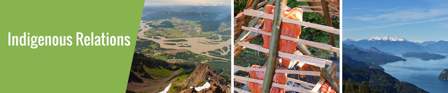
Photo Credit: Chris Kimmel - Fraser River Peak of Mt. Cheam NW view Photo Credit: David Urban - Spuzzum First Nation Salmon Over Fire
The lands and waters within the area we identify as the Fraser Valley Regional District have been home to Indigenous Peoples since time immemorial. The Nlaka'pamux, St'at'imc, Stó:lō, and Sts’ailes Peoples, each with their own distinct history, traditions, and culture, have inherent rights and title to this land, as affirmed by Section 35 of the Constitution Act.
We are dedicated to actively listening, learning and collaborating on opportunities to build a strong and resilient region that benefits everyone. Our commitment to this is reinforced by the adoption of the 2023-2026 Strategic Plan. This plan outlines the steps the FVRD will take to establish partnerships with the Nlaka'pamux, St'at'imc, Stó:lō and Sts’ailes Peoples that are rooted in trust, respect, and openness in the spirit of reconciliation.
The FVRD’s jurisdictional boundaries exist within an intricate and overlapping network of territorial boundaries, interest areas, reserve lands, and administrative precincts. The creation of “Bands” through the Indian Act and the attempted dissolution of traditional governance structures in favour of Western systems has resulted in a complex network of Nations, Tribes, service agencies, treaty associations, reserves, regional districts, municipalities, and communities[1].
Photo Credit: Chris Kimmel - Fraser River Peak of Mt. Cheam NW view Photo Credit: David Urban - Spuzzum First Nation Salmon Over Fire
-
Definitions
Share Definitions on Facebook Share Definitions on X (formerly Twitter) Share Definitions on Linkedin Email Definitions linkTribal Council
An autonomous body with legislative, executive and judicial components. Contemporary councils usually represent a group of First Nations to facilitate the administration and delivery of local programs and services to their members. A tribal council’s communities are united by families and other social units, or relationships through religious, economic and political affiliations.
(First) Nation
Indigenous Peoples who are identified in Canadian law as "Aboriginal" or "Indian" (does not include Métis or Inuit). “First Nations” may refer generally to the many distinct cultural groups in Canada, and the singular “First Nation” can refer to a specific group as an organizational entity, a place, or a political affiliation. The late Justice Vickers (who granted the first declaration of Aboriginal title in Canada) characterized an Indigenous Nation in the same way that French-speaking Canadians are viewed as a “nation” within Canada – namely, a group of people sharing a common language, culture and historical experience.
Service Agency
Several communities that have come together to provide certain services for their community members.
Treaty Association
Several communities that have come together to negotiate modern treaty terms with the federal and provincial governments.
Tribes
It is difficult to have a clear definition of what a tribe is and is not.
According to Duff “On the whole, Stó:lō tribes (excluding Tait) were named clusters of villages which were felt to be related by virtue of any or all of several factors or were grouped by outsiders for description purposes. Close kinship among male nucleus of population, common environment and economic activities, common history, awareness of common traditions, political unity based on a recognition of a main leader and tribal boundaries were all integrative factors. As social and political units, however, the tribes seldom, if ever, had important functions” (p. 87).
Tribal Council
An autonomous body with legislative, executive and judicial components. Contemporary councils usually represent a group of First Nations to facilitate the administration and delivery of local programs and services to their members. A tribal council’s communities are united by families and other social units, or relationships through religious, economic and political affiliations.
(First) Nation
Indigenous Peoples who are identified in Canadian law as "Aboriginal" or "Indian" (does not include Métis or Inuit). “First Nations” may refer generally to the many distinct cultural groups in Canada, and the singular “First Nation” can refer to a specific group as an organizational entity, a place, or a political affiliation. The late Justice Vickers (who granted the first declaration of Aboriginal title in Canada) characterized an Indigenous Nation in the same way that French-speaking Canadians are viewed as a “nation” within Canada – namely, a group of people sharing a common language, culture and historical experience.
Service Agency
Several communities that have come together to provide certain services for their community members.
Treaty Association
Several communities that have come together to negotiate modern treaty terms with the federal and provincial governments.
Tribes
It is difficult to have a clear definition of what a tribe is and is not.
According to Duff “On the whole, Stó:lō tribes (excluding Tait) were named clusters of villages which were felt to be related by virtue of any or all of several factors or were grouped by outsiders for description purposes. Close kinship among male nucleus of population, common environment and economic activities, common history, awareness of common traditions, political unity based on a recognition of a main leader and tribal boundaries were all integrative factors. As social and political units, however, the tribes seldom, if ever, had important functions” (p. 87).
-
Population Statistics
Share Population Statistics on Facebook Share Population Statistics on X (formerly Twitter) Share Population Statistics on Linkedin Email Population Statistics linkThe FVRD’s jurisdictional boundaries exist within an intricate and overlapping network of territorial boundaries, interest areas, reserve lands, and administrative precincts. The creation of “Bands” through the Indian Act and the attempted dissolution of traditional governance structures in favour of Western systems has resulted in a complex network of Nations, Tribes, service agencies, treaty associations, reserves, regional districts, municipalities, and communities[1].
31 communities have 142 reserves that overlap with the boundaries of the FVRD, while 69 entities have expressed interest in lands and waters.
24,010 of 317,670 (7.6%) of the population in the FVRD (off reserve) identify as Indigenous (2021 Census).
[1] Through the Indian Act the some 60 to 80 Nations or Tribes were divided into 633 small federal administrative enclaves called “bands” on some 3,000 reserves (Source: https://www.canada.ca/en/department-justice/news/2017/07/realizing_a_nation-to-nationrelationshipwiththeindigenouspeoples.html)
Jurisdictional Area
Off reserve population
On reserve population[2]
Abbotsford
6,850 of 150,800 (4.5%)
Upper Sumas 6 – 180
Matsqui Main 2 – 100
Aylechootlook 5 - No data
Sahhacum 1 - No data
Chilliwack
7,250 or 91,990 (7.9%)
Kwawkwawapilt 6 – 20
Skwah 4 – 235
Skway 5 – 75
Tzeachten 13 – 435
Yakweakwioose 12 – 50
Aitchelitch 9 – 45
Skowkale – 225
Squiaala 7, 8 – 140
Skwali 3 - 0
Skwahla 2 - 0
Lakeway Cemetery 3 – No data
Lackaway 2 - No data
Schelowat 1 – 5
Grass 15 - No data
Mission
3,380 of 40,630 (8.3%)
Three Islands 3 - No data
Pekw’xe:yles - No data
Langley 2 – 20
Langley 3, 4 - No data
Hope
720 of 6,330 (11.4%)
Hope 1 - 0
Schkam 2 - 65
Tunnel 6 - No data
Greenwood Island 3 - No data
Kawkawa lake 16 - No data
Kent/Agassiz
120 of 5,580 (7.5%)
Lukseetsissum 9 – 45
Seabird Island - 740
Chehalis 6 - No data
Scowlitz 1 - 5
Tseatah 2 - 15
Wahleach Island 2 – No data
Harrison Hot Springs
125 of 1,825 (6.7%)
No reserves
EA A
160 of 475 (33.7%)
Kopchitchin 2 – 35
Teequaloose 3, 3A - No data
Long Tunnel 5A - No data
Yelakin 4, 4A - No data
Austin’s Flat 3 - No data
Paul’s 6 - No data
Boston Bar 8, 9, 10, 11 - No data
Scaucy 5 - No data
Shrypttahooks 7 - No data
Boston Bar 1A - 0
Tuckkwiowhum 1 – No data (30)
Bucktum 4 - No data (5)
Sam Adams 12 - No data
Speyum 3 - No data (0)
Chaumox 11 - No data
Tsawawmuck 1 - No data
Tsintahktl 2 - No data
Boothroyd 5C - No data
Kahmoose 4 - No data (5)
Boothroyd 5A, 5B - No data
Sho-ook 5 - No data
Boothroyd 13 - No data (0)
Inkahtsaph 6 - No data (0)
Boothroyd 6A, 6B - No data
Chukcheetso 7 – No data
Boothroyd 8A - No data (0)
Chapman’s Bar 10 – No data
EA B
70 of 775 (9%)
Chawathil 4 – 160
Ohamil 1 - 140
Spuzzum 1 – 50
Spuzzum 1A - No data
Spuzzum 7 - No data
Stullawheets 8 – 50
Albert Flat 5 – 10
Aywawwis 15 - No data
Trafalgar Flat 13 - No data
Ruby creek 2 - No data (19)
Skawahlook 1 - No data (10)
Klaklacum 12 - No data
Swahliseah 14 - No data
Puckatholetchin 11 - No data (10)
Skawahlum 10 - No data
Kaykaip 7 - No data
Squeah 6 - No data
Qualark 4 - No data
Yale town 1 - No data (5)
Kuthlalth 3 - No data
Yale 18, 19, 20, 21, 22, 23, 24, 25 - No data
Four and one-half mile 2 - No data
Saddle Rock - No data (0)
Stout 8 - No data
Papsilqua 2, 2A, 2B - No data
Skuet 6 - No data
Peters 1, 1A, 2 - No data
EA C
80 of 1,115 (7.2%)
Chehalis 5 – 485
Douglas 8 – No data (66)
Q'alatkú7em – 50
Holachten 8 – 150
Squawkum Creek 3 – 125
Paqulh - No data (0)
Challetkohum 9 - No data
Challetkohum 5 - No data
Samahquam 1 - No data
Sachteen 2A - No data (5)
Sweeteen 3 - No data
Skookumchuck 4 - No data (30)
Skookumchuck 4A - No data
Morteen 9 - No data
Sklahhesten 5, 5A, 5B - No data
Franks 10 - No data
Perrets 11 - No data
Lelachen 6 - No data
Tipella 7 - 0
Glazier Creek - No data
Williams 2 - No data
EA D
75 of 1,995 (3.8%)
Cheam 1 – 200
Popkum 1 - No data (0)
Popkum 2 - No data
EA E
145 of 1,460 (9.9%)
EA F
150 of 1380 (10.9%)
EA G
180 of 1,685 (10.7%)
Lakahahmen 11 – 45
Skweahm 10 – 45
Sumas Cemetery 12 - No data
Papekwatchin 4 - No data
Yaalstrick 1 - No data
Zaitscullachan 9 - No data
Skumalasph 16 - No data
EA H
115 of 2420 (4.8%)
Soowahlie 14 – 180
[2] All counts in census tabulations undergo random rounding, a process that transforms all raw counts into randomly rounded counts. This reduces the possibility of identifying individuals in the tabulations
The FVRD’s jurisdictional boundaries exist within an intricate and overlapping network of territorial boundaries, interest areas, reserve lands, and administrative precincts. The creation of “Bands” through the Indian Act and the attempted dissolution of traditional governance structures in favour of Western systems has resulted in a complex network of Nations, Tribes, service agencies, treaty associations, reserves, regional districts, municipalities, and communities[1].
31 communities have 142 reserves that overlap with the boundaries of the FVRD, while 69 entities have expressed interest in lands and waters.
24,010 of 317,670 (7.6%) of the population in the FVRD (off reserve) identify as Indigenous (2021 Census).
[1] Through the Indian Act the some 60 to 80 Nations or Tribes were divided into 633 small federal administrative enclaves called “bands” on some 3,000 reserves (Source: https://www.canada.ca/en/department-justice/news/2017/07/realizing_a_nation-to-nationrelationshipwiththeindigenouspeoples.html)
Jurisdictional Area
Off reserve population
On reserve population[2]
Abbotsford
6,850 of 150,800 (4.5%)
Upper Sumas 6 – 180
Matsqui Main 2 – 100
Aylechootlook 5 - No data
Sahhacum 1 - No data
Chilliwack
7,250 or 91,990 (7.9%)
Kwawkwawapilt 6 – 20
Skwah 4 – 235
Skway 5 – 75
Tzeachten 13 – 435
Yakweakwioose 12 – 50
Aitchelitch 9 – 45
Skowkale – 225
Squiaala 7, 8 – 140
Skwali 3 - 0
Skwahla 2 - 0
Lakeway Cemetery 3 – No data
Lackaway 2 - No data
Schelowat 1 – 5
Grass 15 - No data
Mission
3,380 of 40,630 (8.3%)
Three Islands 3 - No data
Pekw’xe:yles - No data
Langley 2 – 20
Langley 3, 4 - No data
Hope
720 of 6,330 (11.4%)
Hope 1 - 0
Schkam 2 - 65
Tunnel 6 - No data
Greenwood Island 3 - No data
Kawkawa lake 16 - No data
Kent/Agassiz
120 of 5,580 (7.5%)
Lukseetsissum 9 – 45
Seabird Island - 740
Chehalis 6 - No data
Scowlitz 1 - 5
Tseatah 2 - 15
Wahleach Island 2 – No data
Harrison Hot Springs
125 of 1,825 (6.7%)
No reserves
EA A
160 of 475 (33.7%)
Kopchitchin 2 – 35
Teequaloose 3, 3A - No data
Long Tunnel 5A - No data
Yelakin 4, 4A - No data
Austin’s Flat 3 - No data
Paul’s 6 - No data
Boston Bar 8, 9, 10, 11 - No data
Scaucy 5 - No data
Shrypttahooks 7 - No data
Boston Bar 1A - 0
Tuckkwiowhum 1 – No data (30)
Bucktum 4 - No data (5)
Sam Adams 12 - No data
Speyum 3 - No data (0)
Chaumox 11 - No data
Tsawawmuck 1 - No data
Tsintahktl 2 - No data
Boothroyd 5C - No data
Kahmoose 4 - No data (5)
Boothroyd 5A, 5B - No data
Sho-ook 5 - No data
Boothroyd 13 - No data (0)
Inkahtsaph 6 - No data (0)
Boothroyd 6A, 6B - No data
Chukcheetso 7 – No data
Boothroyd 8A - No data (0)
Chapman’s Bar 10 – No data
EA B
70 of 775 (9%)
Chawathil 4 – 160
Ohamil 1 - 140
Spuzzum 1 – 50
Spuzzum 1A - No data
Spuzzum 7 - No data
Stullawheets 8 – 50
Albert Flat 5 – 10
Aywawwis 15 - No data
Trafalgar Flat 13 - No data
Ruby creek 2 - No data (19)
Skawahlook 1 - No data (10)
Klaklacum 12 - No data
Swahliseah 14 - No data
Puckatholetchin 11 - No data (10)
Skawahlum 10 - No data
Kaykaip 7 - No data
Squeah 6 - No data
Qualark 4 - No data
Yale town 1 - No data (5)
Kuthlalth 3 - No data
Yale 18, 19, 20, 21, 22, 23, 24, 25 - No data
Four and one-half mile 2 - No data
Saddle Rock - No data (0)
Stout 8 - No data
Papsilqua 2, 2A, 2B - No data
Skuet 6 - No data
Peters 1, 1A, 2 - No data
EA C
80 of 1,115 (7.2%)
Chehalis 5 – 485
Douglas 8 – No data (66)
Q'alatkú7em – 50
Holachten 8 – 150
Squawkum Creek 3 – 125
Paqulh - No data (0)
Challetkohum 9 - No data
Challetkohum 5 - No data
Samahquam 1 - No data
Sachteen 2A - No data (5)
Sweeteen 3 - No data
Skookumchuck 4 - No data (30)
Skookumchuck 4A - No data
Morteen 9 - No data
Sklahhesten 5, 5A, 5B - No data
Franks 10 - No data
Perrets 11 - No data
Lelachen 6 - No data
Tipella 7 - 0
Glazier Creek - No data
Williams 2 - No data
EA D
75 of 1,995 (3.8%)
Cheam 1 – 200
Popkum 1 - No data (0)
Popkum 2 - No data
EA E
145 of 1,460 (9.9%)
EA F
150 of 1380 (10.9%)
EA G
180 of 1,685 (10.7%)
Lakahahmen 11 – 45
Skweahm 10 – 45
Sumas Cemetery 12 - No data
Papekwatchin 4 - No data
Yaalstrick 1 - No data
Zaitscullachan 9 - No data
Skumalasph 16 - No data
EA H
115 of 2420 (4.8%)
Soowahlie 14 – 180
[2] All counts in census tabulations undergo random rounding, a process that transforms all raw counts into randomly rounded counts. This reduces the possibility of identifying individuals in the tabulations